Maps
Page on The Philippines
Outline
- Physical
Environment
- Ecoregions
- 18
Major River Basins in the Philippines
- Land
Cover
- Weather
& Climate
- Climate
Types
- Risk
to Projected Temperature Increase
- Combined
Risk to Geophysical Disasters
- Human
Environment
- Population
Density by City and Municipality
- Map
of Regional Access to Healthcare, Drinking Water, and Transportation
- 2018,
Income Map
- Road
maps
- Cebu
City
- Quezon
City
- Manilla
- City
Maps
- Cebu
City
- Quezon
City
- Manilla
- Urban
Transportation Maps
- Cebu
City Proposed BRT
- Quezon
City
- Kalakhang Maynila, Greater Manilla Transit Map
- Tourist
Maps
- Tourist
Sites
- Pasalubong
Map
- Things
to Do in Cebu
1
Physical Environment
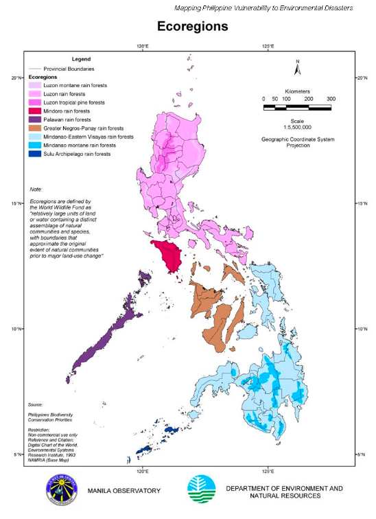

There are
nine ecoregions of The Phillipine Islands. The northernmost region of the
country is classified as having Luzon Rain Forests, further broken down into
Luzon Montane, covering higher elevations like the Northern and Southern Sierra
Madre and Zambales Mountains. The Luzon Tropical Pine Forests are located
within areas above 1,000 meters exluding the montane forest expanse on the
northern end of the island. The Mindoro Rain Forests ecoregion is located on
the island of Mindoro and is condisdered a tropical wet climate. Further south
is the greater Negros- Panay rain forest ecogregion to include the Western
Visayas, the climate for this region is tropical wet as well and can receive
2,419mm of rainfall annually. On the Southeastern portion of the islands are
the Mindanao ecoregions, a humid region categorized with mossy uper montane
forest at elevations of 1,200 to 1,500m.
Caption
Source:
Sawe,
Benjamin Elisha. "Ecological Regions Of The Philippines." WorldAtlas,
Apr. 25, 2017,
worldatlas.com/articles/ecological-regions-of-the-philippines.html.
https://www.worldwildlife.org/ecoregions/im0128
18
Major River Basins in the Philippines
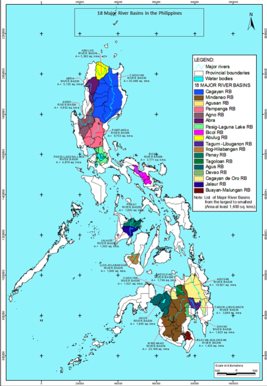
18 major river basins throughout the islands,
they cover an area of 108,678 km2 equivalent to 36.2% of the total
land area of the Philippines. The Pasig-Marikina-Laguna de Bay Basin is a major
river basin that serves the Metro Manila area (a population of 11 million in
2000) and the surrounding towns (at 3 million).
Caption Source:
http://hywr.kuciv.kyoto-u.ac.jp/ihp/riverCatalogue/Vol_05/9_Philippines.pdf
Land
Cover in The Philippines

The most prominent land cover in the
Philippines is wooded grassland covering over 90% of the country with the
latter being Evergreen Broadleaf Forest on the most eastern side, and the
exception of the Padawan Islands in the west.
2
Weather & Climate
Climate
Types
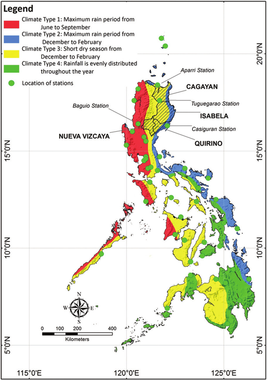
The climate types in the Philippines based on
Modified Coronas Climate Classification are defined according to seasonality of
rainfall. They are divided into 4 types and depict the time of the year that a
respective area receives the most mount of rainfall. The map also depicts
weather station locations distributed throughout the country.
Risk
to Projected Temperature Increase

Assessed areas affected by projected
temperature increase by 2080. Areas that are most at risk are Mindanao and
Central Visayas Islands. It is estimated for 20 provinces to be at risk, as
depicted by the red and darker shade of red on the map.
Combined
Risk to Geophysical Disasters

The Southernmost Islands of the Philippines are
at a higher risk than those further north. These risks are earthquakes,
earthquake-induced landslides, volcanic eruptions, and tsunamis. It is
important to note that these areas are mostly rural, low-income areas of the
country.
3 Human
Environment

As one may assess, areas with high population densities
do correlate with city or municipal centers. The data gathered on the year 2000 population density is defined
5 km by 5 km grids and was obtained from the National Statistics Office and
from municipal data.
Map of Regional Access to Healthcare,
Drinking Water, and Transportation
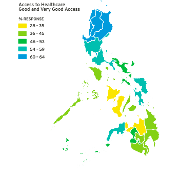
“In a survey conducted, about 3.8 percent of Filipinos in the
National Capital Region said they did not have reliable electricity in their
homes, whereas more than 10 percent of those living in MIMAROPA or ARMM were
without reliable electricity. When asked about their access to healthcare
facilities (Table 5), 52 percent of those surveyed said they had either good or
very good access to these facilities. Fifty-six percent said they had good
access to transportation, but only 45 percent of Filipinos felt they would have
good or very good access to transportation when an evacuation order is issued.
Almost half, 49 percent, of Filipinos claimed they could access an evacuation
center. On average, 71 percent of Filipinos felt they had good or very good
access to safe drinking water, though numbers varied widely across regions with
only 46 percent of people living in Negros Island Region claiming access to
safe drinking water and only 52 percent of those living in ARMM”
Caption Source:
https://hhi.harvard.edu/sites/default/files/publications/prc-phillippine-report-final_0.pdf
Full Year 2018, Poverty Incidents Amongst
Families

Poverty in the Philippines has reduced from 2015 to 2018. The
lowest percentage of poverty incidence is located in the city of 0.2%, and is
as high as 17.1% in the city of Butuan. From this map we can gather that the
least poor areas are centered around the capital and adjacent cities, and the
poorest areas are more rural, located on the southern end of the archipelago.
4
Road Maps
Cebu
City, GoogleMaps
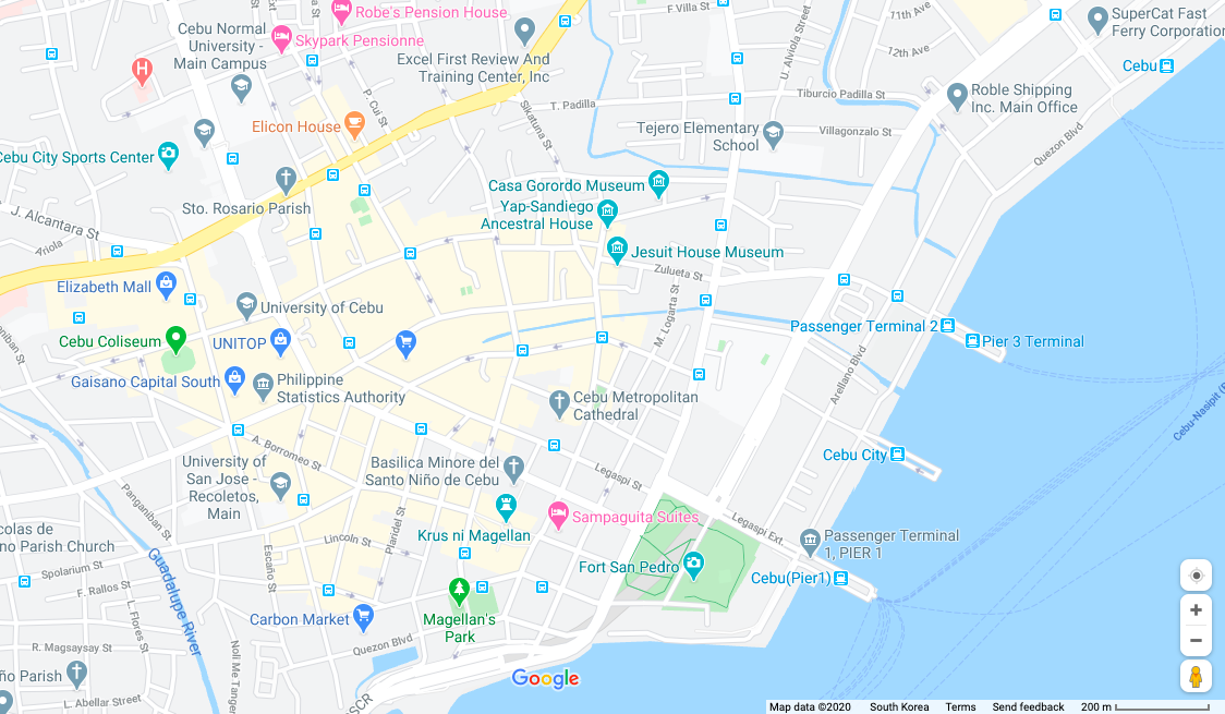
Cebu City is an energetic, lively, and thriving
metropolis. It is one of the Philippines capital cities. Energy in the city is
described as infectious for nightlife. The area also attracts many Chinese and
Korean cosmopolitans, due to the various universities in the area.
Quezon City, GoogleMaps
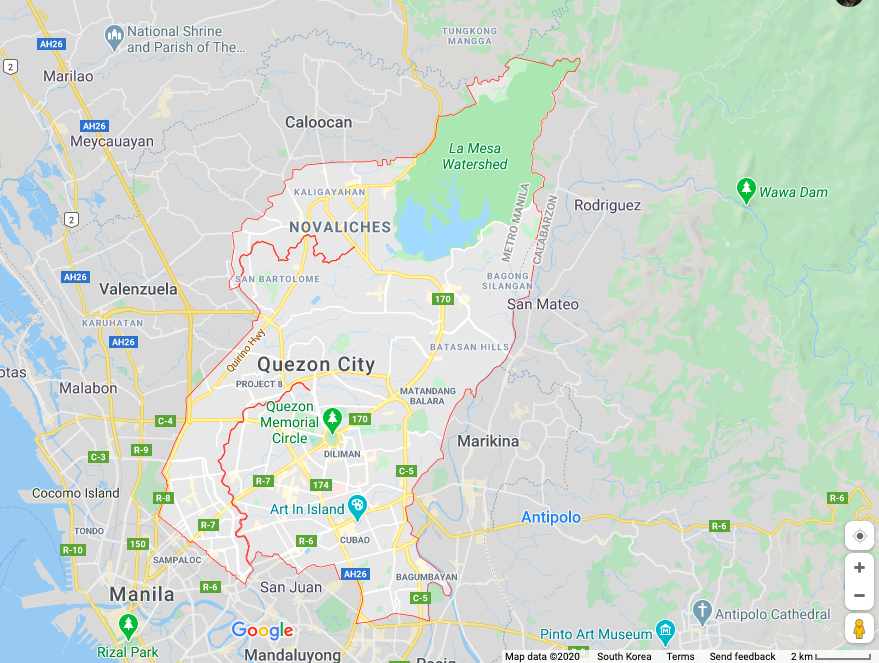
Located north east of Manila, Quezon City was
the former capital of the Philippines. At the center is a 25 hectare central
green similarly styled like New York’s Central Park.
Manila
Capital City, GoogleMaps
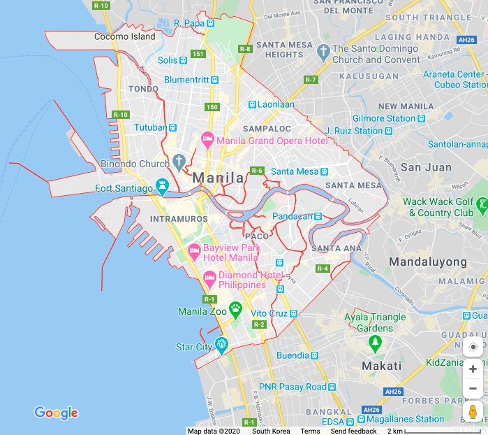
Manila City is considered the most densely
populated city in the world. Located on the northwestern coast of the
Philippines, its 1.6 million people consists of the people living in the
business district of Makati City and the impoverished communities on its
outskirts.
5
City Maps
Cebu City
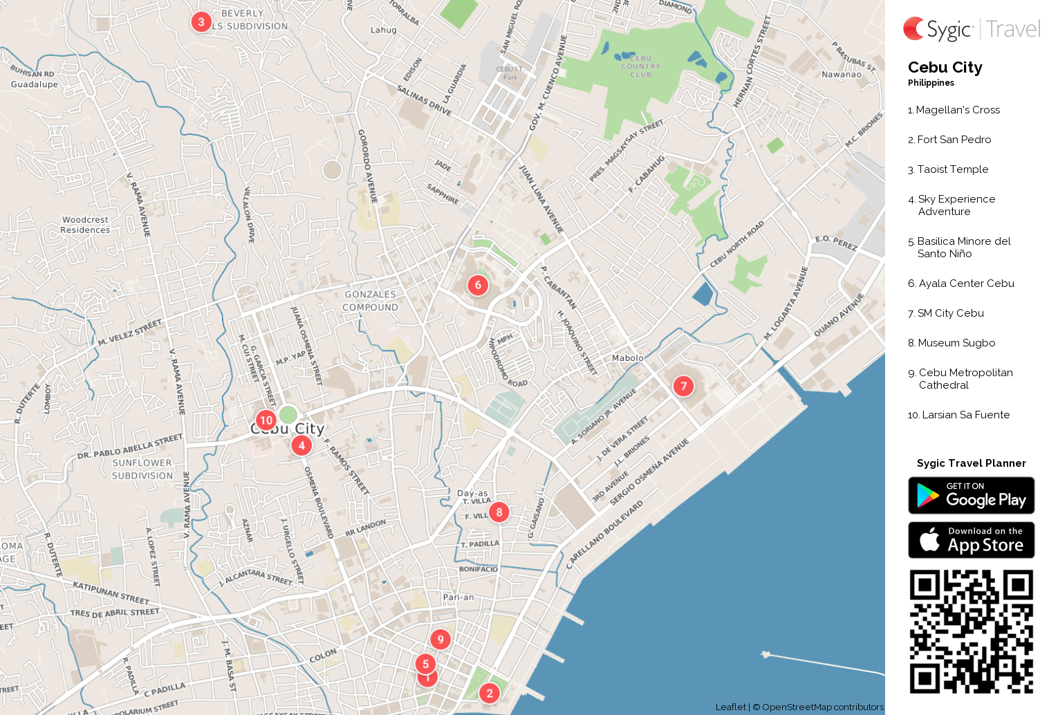
Another look at Cebu City, featuring a
scannable QR code with popular tourist sites.
Quezon City
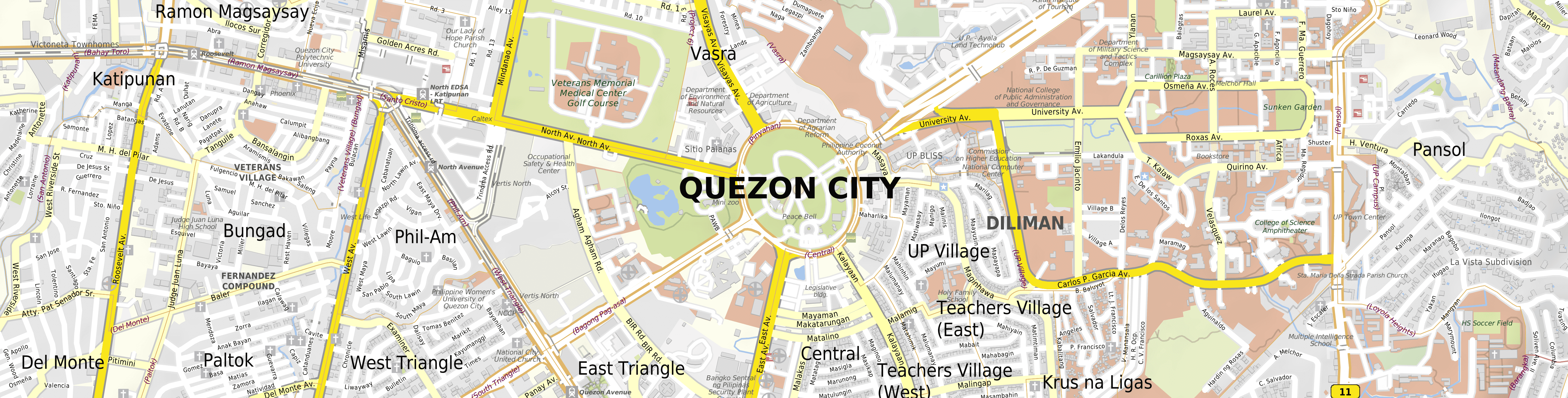
A closer look at Quezon City and its radial
city layout, depicting different zip code areas.
Manila Capital City
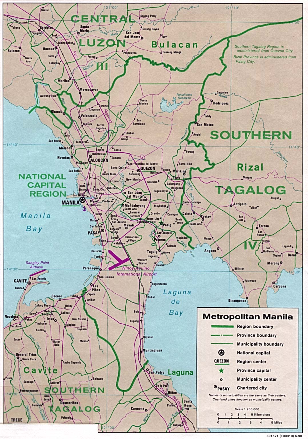
The Metropolitan Manila area is highlighted by its respective regional
boundaries, provincial boundaries, and municipal boundaries. The national
capital, municipality center, and chartered cities are also areas of importance
that can be used as a point of reference. It is important to note the purple
lines depicting rail lines and the Pan Phillipine
Highway.
6
Urban Transportation
Cebu
City Proposed Bus Rapid Transit Plan

Currently, Cebu City does not have a mass
transit system, however there are current plans to create the Cebu Bus Rapid
Transit System, the first operational bus rapid transit project in the Phillipines. It is set to launch March 15, with at least 20
buses. The planned route will start from the South Road properties and end at
the Fuente Osmeña circle with 15 stops.
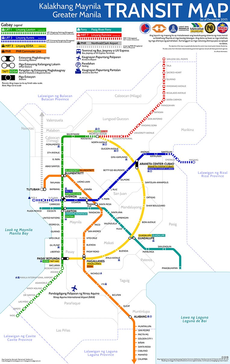
Quezon
City, Urban Transportation
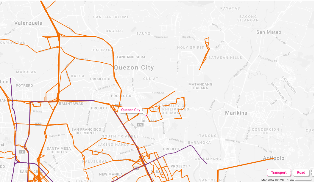
Highlighted are the routes that reach Quezon
City originating from the Metro Manila area, called the Jeepney via the Land
Transportation Franchising and Regulation Board. The purple delineates the
train route from Recto to Cubao.
Manilla
Urban Transit
The most comprehensive public transportation is expected to be in
the capital city of Manila, featuring plane, train and airports.
7 Tourist
Sites
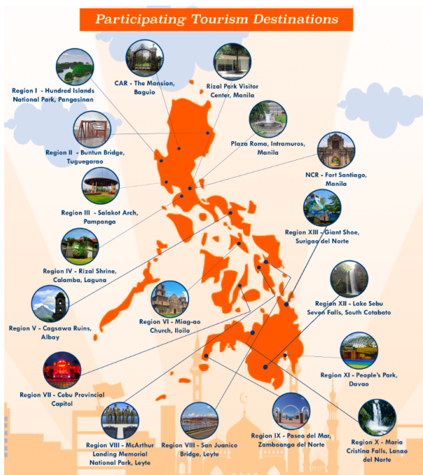
The Philippine Commission on Women and the
Department of Tourism created this informational graphic in an effort to
promote public awareness on Violence Against Women. According to their site,
the idea behind this creative advocacy effort is to raise consciousness through
safe and non-exploitative tourism activities.
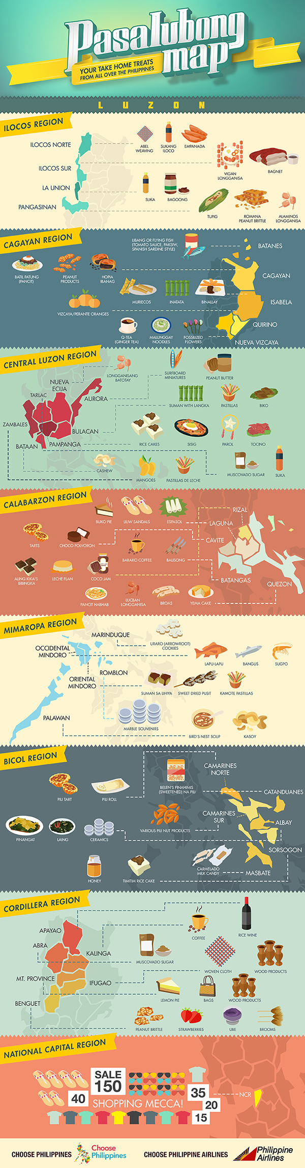
Pasalubong is a Filipino word that describes a tradition of
bringing back gifts to loved ones from a place one has visited. Different
regions specialize in different food items and goods which make shopping for
souvenirs a breeze!
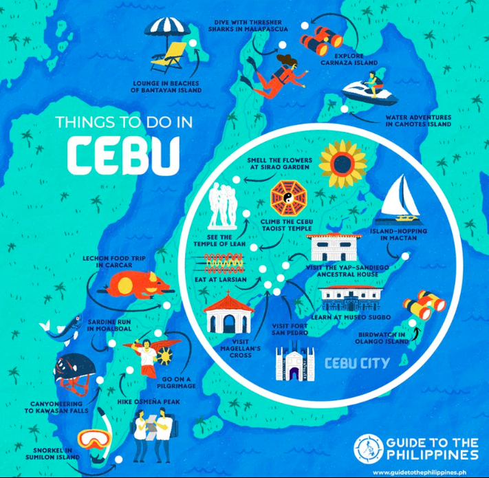
The popular tourist destination, the island of Cebu, is also known
as the Lechon capital and located in the central Visayas region. Like many of
the other islands that the Philippines offers, Cebu and its surrounding islands
feature plenty of activities from hiking, to shopping, to exploring landmarks
from its 16th century Spanish colonial past.
Submitted by Suzanne Lopez on Mar 06, 2020.