Street View Page on
The Philippines
Google
Street View is available through Google Maps and Google Earth and provides
panoramic views along many streets in the world. It was started in 2007 in the
United States and has since expanded to include a large number of countries.
Some countries have objected to this form of data gathering and have not
allowed Google to take the imagery, Germany being the main hold-out. Available
Street View imagery available is shown as blue lines on Google Maps once the
so-called pegman has been activated. Images are most
often taken by car but a variety of other modes of transport have been used.
Once captured, the images are subsequently stitched together. In some areas,
Street View images are augmented by privately-done photospheres.
Outline
- Street View screen captures
- Polillo Baywalk
- Nagkalit- kalit
Waterfalls
- Banaue Rice Terraces
- Links to Street View panoramas
- Polillo Baywalk
- Nagkalit- kalit
Waterfalls
- Banaue Rice Terraces
- MapChannels Street View Animation
- Poblacion P Burgos- Polillo
- Christ is the Answer
Church- Banaue to Banaue Rice Terrace Farms
- Route from El Nido
Elementary School to Nagkalit-kalit Waterfalls
- Moore's Where to Invade Next
- The value of travel
1 Street View
Screen Captures
Polillo Baywalk
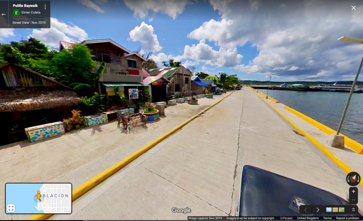
Polillo originates from the Chinese word “pulilu”
which translates roughly to beautiful island with plenty of food. Located in the
northeastern region it is separated from Luzon Island.
Nagkalit-kalit Waterfalls
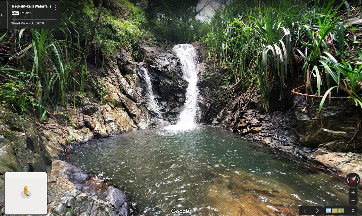
About a 40 minute hike up along the river are these tiny but magical looking falls that provide pools a visitor may be able to swim in. It is reccomnded to hire a guide in this area to avoid getting lost.
Banaue Rice Terraces

Off the side of the road lies this overlook frequented by
many tourists and curious observers.
2 Links to Street
View Panoramas
Insert three links with descriptions to Street View Panoramas here. In contrast to above, these are "live links" so you'll be able to spin the image once they appear.
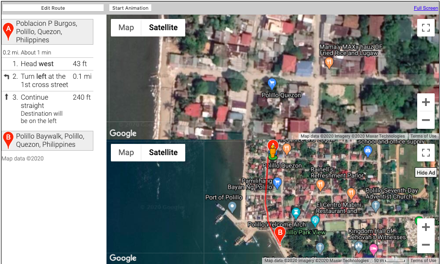
Link 1: Polillo Baywalk This area is
the Polilllo Baywalk, lined
with colorful small oceanside houses and shacks overlooking Polillo
Bay, this area on a bright and sunny day seems like the perfect place to relax
and have a nice afternoon stroll.
Link 2: Nagkalit-kalit Waterfalls A few locals are seen hiking
upstream along the water carved rocks.
Link 3: Banaue Rice Terraces A popular spot for tourists, this spot offers incredible views of the rice terraces, one may notice the small abodes of the local people who are most likely farmers that tend the rice terraces.
3 MapChannels Streetview Player

StreetView animation near Banaue Rice Terraces
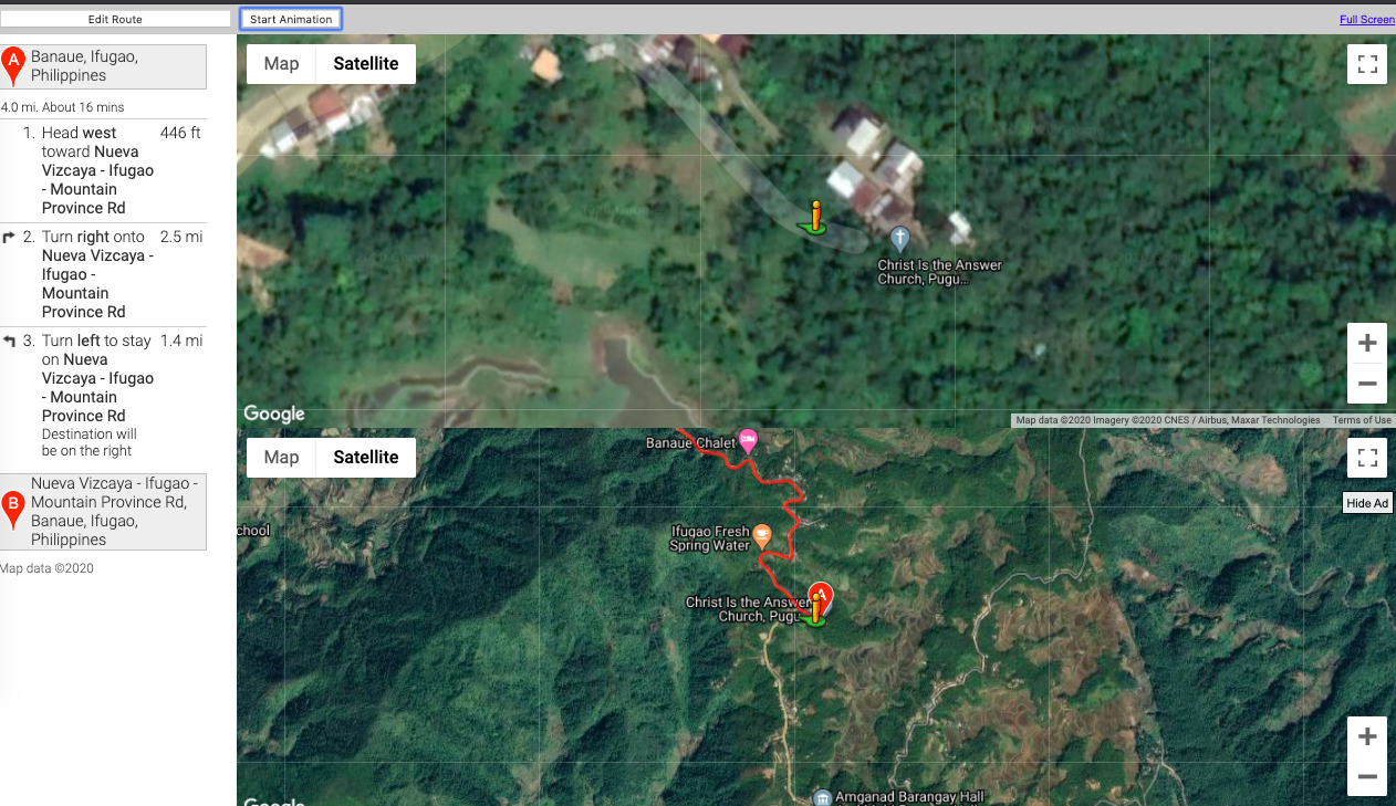
Desription: A Street View animation that takes us between two locations through the winding hills in the province of Ifugao. As we travel through, we are able to see common types of housing that the local villagers live in, it is also important to note the narrow roads.
Description: In this animation, walking directions are in beta so we do not have a webcam perspective for this particular area. We are able to see that this walk is less than a half a mile away
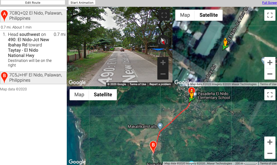
Description: We begin the journey from the outskirts of town then make our way directly down the road and stop a little before the waterfall trailhead.
4 Moore's Where
to Invade Next
Moore's documentary is politically polarizing. Conservative columnists, such as Armon White, are sharply critical of the movie. First, comment on the validity of White's negative review. Then, putting aside politics, what can the movie show us about the value of travel in understanding our own country.
Armon White makes valid although passionate responses to Moore’s film. His comments regarding the film’s representation of propaganda are valid as Moore, someone living in the United States presented himself in a way that did not show pride rather displayed anti-nationalist characteristics. Moore describes the film as shallow and lacking credibility which are both valid as Moore presented information strongly based off of opinions of the citizens he spoke to. It would have added credibility if Moore presented both sides of the argument, however showing one side of the story may influence the viewer to create opinions solely based on whatever is being presented. This is further criticized by White by the following excerpt “Moore uses satire dishonestly, hoping to achieve small-minded ideological power”.
All negative commentary aside, the film captures positive movements and societal European standards that may benefit American society if implemented. This documentary provides a look into foreign cultures and forces a watcher to take an introspective look on their own values and customs. It provides a different perspective and offers solutions that could not only benefit an individual but have the possibility to improve overall quality of life for Americans.
Submitted
by Suzanne Lopez on 13 Apr 2020.